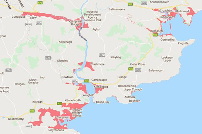
Parts of Tallow and Curraglass could be under water by the year 2100 according to Climate Central’s sea-level rise and coastal flood maps.
Climate Central has released a new interactive map displaying land projected to be below the annual flood level in 2100. The new maps are based on peer-reviewed science in leading journals.
With the River Bride and River Glenaboy flowing through Tallow, the new map projects that Tallow could be affected as early as 2030.
According to the map, from the intersection of the River Bride and River Blackwater, lands along the River Bride as far as Curraglass are likely to be below annual flood level as early as 2030.
Coverage in this week’s Print & Digital Edition


