

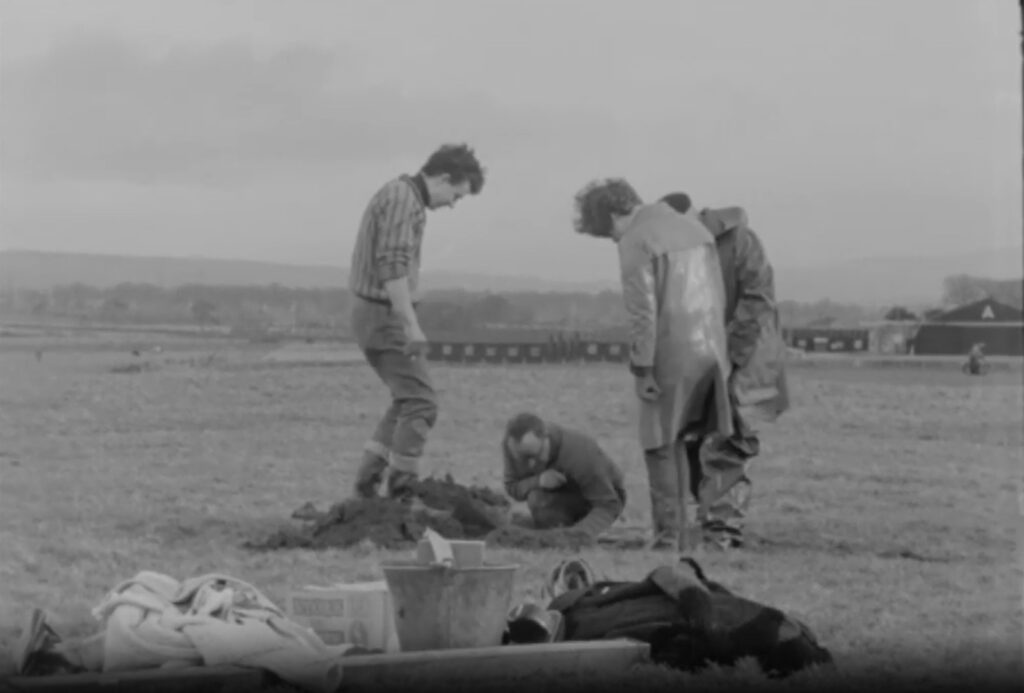
Improvement works on the old golf course in Fermoy in the mid 1960s, which at that time was located at Carrignagroghera (Aerodrome/Ballyarthur area of the town), uncovered an underground passage which necessitated further investigation by archaeologists.
Professor of Archaeology at UCC, Michael J O’Kelly and his team were called onsite in early 1966, when work on building a golf tee box brought an unexpected find. Interviewed on the course in February 1966 by RTE, as golfers blissfully played on the course behind them, Professor O’Kelly explained the significance of the find.
“This work on the golf course has drawn attention to a ringfort, which has been here since perhaps the early Christian period. In taking some soil from this for the building of a golfing tee, the top of the roof of a souterrain underground passage was revealed.
“And what we are now doing is trying to make a survey and record of the inside of this, and the ringfort itself for the national records of our ancient monuments,” he said.
Referring to an ‘ancient count made a long time ago by the late TJ Westropp’ (archaeologist and antiquarian), Prof O’Kelly estimated at the time that were ‘something like 30,000’ ringforts ‘spotted all over the country.’
We now know that there are about 40,000 examples throughout the country. Ringforts take the form of circular fortified settlements that were primarily built during the Bronze Age up to about the year 1000. Many contained souterrains, which are underground passages or chambers, used as escape routes in case of an attack as well as being a place to conceal valuables and provide storage for food and animals.
OFFICIAL RECORD
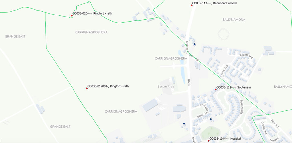
Details of the find on the Heritage Data maps, cites two finds in Carrignagroghera:
A ‘ringfort – rath’, which due to ‘levelling activities in connection with the uses of the area (race-course, military airfield, golf course and driving green)… have repeatedly interfered with the site’. According to O’Kelly and Shee (1968, 46), remains consisted of ‘platform-like structure (diam. 41m) with some evidence of a slight bank on the edge of the platform and a slight external ditch.’
Also, a souterrain was uncovered, located to the west of the ringfort, described as follows: ‘At W side of and extending underneath bank of levelled ringfort (CO035-01901-). Recorded by O’Flanagan (1844, 101) as ‘subterranean chambers’. Investigated by O’Kelly and Shee (1968, 45-6) after roof of chamber was penetrated by machinery.
Initial inspection showed that chamber was previously opened at the same point and then backfilled and a large stone used to block the opening. Site consisted of roughly circular stone-built chamber (diam. c. 3m; H 2.6m) with corbelled roof; creepway (H c. 0.5m; Wth c. 0.5m) at E side to stone-built passage (min. L 4.5m; Wth c. 2m; H c. 2.3m; long axis E-W) which tapered at both ends.
Dimensions of passage suggest use as a chamber also; sides and W wall corbelled to enable it to be roofed by very short light lintels; E end blocked but probing suggested that passage extended further to E. No visible surface trace.’
Nowadays, the club is of course sited at Corrin Hill a short distance outside the town, having moved there in 1972. Designed by John Harris, this fine 18 hole, par 70 heathland course measures 5,831m in length.


, uncovered an underground passage which necessitated further investigation by archaeologists.)